The debate over LiDAR versus pure vision for autonomous safety is settled not by brand loyalty, but by the physics of failure: vision systems infer, while LiDAR measures, creating a fundamental difference in reliability.
- LiDAR’s deterministic 3D measurement drastically reduces “phantom braking” incidents common in systems relying on probabilistic inference from 2D camera data.
- The historic cost barrier of LiDAR is collapsing due to the industry’s shift to solid-state “chipification,” making it a viable and scalable solution for mass-market deployment.
Recommendation: For maximum safety, engineers must implement a sensor fusion hierarchy where LiDAR provides the primary ground truth for object detection, with cameras and radar serving as redundant layers for classification and velocity tracking.
The central debate in autonomous vehicle development is no longer about if, but how, a car perceives the world. Two philosophies dominate: pure vision, which relies on cameras and sophisticated AI to interpret a 2D world, and sensor fusion, which typically anchors its perception in the precise, 3D data from LiDAR. For engineers and investors, choosing a side is a high-stakes bet on the future of mobility and safety. While the vision-only approach championed by some has shown remarkable progress, it operates on a foundation of probabilistic inference, essentially making educated guesses about depth and distance.
Conventional analysis often gets stuck on surface-level arguments: cameras are inexpensive, while LiDAR is historically costly. This simplification misses the core engineering truth. The most critical question is not “which is cheaper?” but “what are the inherent failure modes of each technology, and how can they be mitigated?” A system’s safety is defined by its performance in edge cases—dense fog, sudden obstacles, or confusing road infrastructure. Understanding the physical limitations of light and data processing is paramount to building a truly robust perception stack.
This analysis moves beyond the platitudes to dissect the underlying mechanics of each sensor modality. We will explore why cameras fundamentally struggle where LiDAR excels, how the economics of LiDAR are being rewritten by solid-state technology, and how a multi-sensor hierarchy provides the only credible path toward redundant, verifiable safety. The goal is not to declare a single winner, but to provide a technical framework for evaluating and engineering the safest possible autonomous systems.
To provide a comprehensive technical analysis, this article is structured to address the most critical engineering and strategic questions. The following sections will guide you through the core trade-offs, from physical limitations to algorithmic tuning, in the LiDAR versus vision debate.
Summary: Lidar vs Pure Vision: Which Sensor Stack Is Safer for Autonomous Driving?
- Why Cameras Struggle with Depth in Fog Where Lidar Succeeds?
- How to Bring Lidar Unit Costs Down from $10,000 to $500?
- Solid State vs Mechanical Lidar: Which Offers Better Durability for Robotaxis?
- The “Phantom Braking” Risk: Does Lidar Reduce False Positives?
- How to Combine Radar, Lidar, and Cameras for Redundant Safety?
- How to Adjust Algorithm Thresholds to Balance Sensitivity and Specificity?
- Li-SoCl2 vs Alkaline: Which Battery Chemistry Survives Minus 30 Degrees?
- How to Train Delivery Bots to Handle Sidewalk Obstacles and Pedestrians?
Why Cameras Struggle with Depth in Fog Where Lidar Succeeds?
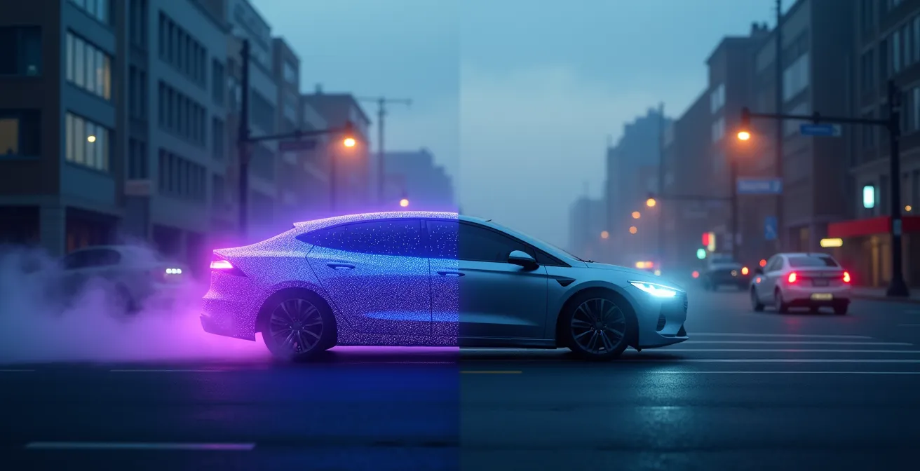
The fundamental limitation of camera-based systems in adverse weather like fog, heavy rain, or snow lies in the physics of light and data interpretation. Cameras capture 2D images and rely on AI algorithms to perform probabilistic inference to estimate depth and identify objects. Fog consists of suspended water droplets that scatter visible light, drastically reducing contrast and obscuring details. For a neural network, this creates a low signal-to-noise ratio, making it incredibly difficult to distinguish a pedestrian from the background or even recognize that an object is present at all.
In contrast, LiDAR (Light Detection and Ranging) operates on a principle of deterministic measurement. It emits pulses of infrared laser light and measures the precise time it takes for those pulses to reflect off objects and return to the sensor. This “time-of-flight” calculation provides a direct, unambiguous measurement of distance, creating a 3D point cloud of the environment. While the infrared light used by LiDAR can also be affected by very dense fog, its wavelength and the power of the signal are far more resilient to scattering than visible light.
The result is that even when a camera’s view is a uniform gray, a LiDAR sensor can still detect the geometric presence of an object. A recent Rivian’s comparison test demonstrates that camera systems can completely ‘miss’ pedestrians crossing in foggy conditions, while the accompanying LiDAR system successfully detects all environmental elements. This is not a failure of the AI, but a failure of the input data; the AI cannot process information that the camera sensor is physically unable to capture. This makes LiDAR a critical component for achieving Level 4 and Level 5 autonomy, where the system must operate safely without human intervention in all conditions.
How to Bring Lidar Unit Costs Down from $10,000 to $500?
The primary historical argument against widespread LiDAR adoption has been its prohibitive cost, with early mechanical units famously costing tens of thousands of dollars. This is changing rapidly due to a fundamental technological shift: the move from bulky, spinning mechanical LiDARs to compact, robust solid-state LiDAR. This transition is the key to driving unit costs down into the hundreds of dollars, making the technology viable for mass-market consumer vehicles.
Mechanical LiDARs use a small number of lasers and detectors mounted on a spinning motor to scan the environment. These moving parts are complex to manufacture, require precise calibration, and are susceptible to wear and tear, all of which contribute to their high cost and limited durability. Solid-state systems, by contrast, have no moving parts. They leverage technologies like MEMS (Micro-Electro-Mechanical Systems) mirrors or Optical Phased Arrays (OPAs) on a silicon chip to steer the laser beam electronically. This process, often called “chipification,” allows LiDAR sensors to be produced using scalable semiconductor manufacturing techniques, similar to computer chips.

This manufacturing scalability is unlocking exponential cost reductions and performance improvements. As a result, the global solid-state LiDAR market is projected to grow from $1.18B in 2024 to $7.44B by 2032, a clear indicator of industry and investor confidence. The economic path forward is clear, with solid-state technology poised to displace its mechanical predecessors.
This table from a MarketsandMarkets report illustrates the market dynamics and the clear cost trajectory favoring solid-state solutions.
| Technology | 2022 Market Size | Key Advantage | Cost Trajectory |
|---|---|---|---|
| Mechanical LiDAR | $2,225 million | Established presence | High cost, limited reduction potential |
| Solid-State LiDAR | $7 million | No moving parts | Projected to reach hundreds of dollars per unit |
Solid State vs Mechanical Lidar: Which Offers Better Durability for Robotaxis?
For high-utilization commercial applications like robotaxis or delivery fleets, durability and reliability are as critical as initial cost. Vehicles operating 18-24 hours a day cannot afford sensor downtime. In this context, solid-state LiDAR offers a decisive advantage over traditional mechanical systems. The core reason is the elimination of moving parts. Mechanical LiDAR units rely on precision motors spinning at high RPMs, which are inherent points of failure due to friction, vibration, and environmental stressors like temperature fluctuations and shock.
Solid-state LiDARs, being built on a semiconductor foundation, are intrinsically more robust. They are essentially a single, integrated component with no macroscopic moving parts to wear out. This makes them far more resistant to the shock and vibration common in daily vehicle operation. Their compact form factor also allows for better integration into the vehicle’s body, protecting them from the elements and minor impacts, unlike the often-exposed “spinning can” of a mechanical unit. This enhanced durability translates directly to higher uptime and a lower total cost of ownership, a critical metric for any fleet operator.
The market is rapidly adopting this more durable technology. Major suppliers are scaling production to meet the demand not just from automotive OEMs but also from the burgeoning robotics sector. For instance, Hesai Technology projects shipping 1.2 to 1.5 million units in 2025, with a significant portion earmarked for robotics. This scale demonstrates growing confidence in the reliability of modern LiDAR for continuous, demanding operations. For a robotaxi fleet, choosing a solid-state system is not just an upgrade; it’s a foundational requirement for a viable business model.
The “Phantom Braking” Risk: Does Lidar Reduce False Positives?
“Phantom braking” is a dangerous phenomenon where an autonomous or semi-autonomous vehicle brakes suddenly and aggressively for a non-existent threat. This issue has plagued systems that rely heavily on radar and camera data, creating a significant safety risk. The problem arises from the sensor’s misinterpretation of ambiguous data. For example, a radar system might interpret a metallic manhole cover or an overhead bridge as a stationary vehicle in the car’s path, triggering an emergency stop. This is a classic example of a false positive—the system has low specificity.
The prevalence of this issue is significant. For some systems, the problem became so acute that it triggered regulatory scrutiny, with the NHTSA received 354 complaints in 9 months related to phantom braking in a single manufacturer’s vehicles. These events erode driver trust and create hazardous situations, particularly in dense, high-speed traffic.
Tesla’s Shift from Radar and the Challenge of Phantom Braking
Tesla’s experience with radar provides a telling case study. The company’s earlier Autopilot systems incorporated radar, but its performance was susceptible to phantom braking. The radar would often misclassify benign objects like manhole covers or bridge underpasses as road hazards, causing the vehicle to brake unnecessarily. In an effort to solve this, Tesla eventually transitioned to its “Tesla Vision” system, removing radar entirely and relying solely on cameras. While this aimed to resolve conflicts between sensor inputs, it shifted the burden of perception entirely onto a system that must infer depth from 2D data, creating a different set of challenges.
LiDAR fundamentally mitigates this risk by providing high-resolution, three-dimensional data. Instead of just detecting a reflection, LiDAR maps the precise shape, size, and location of an object. An overpass is clearly identified as being far above the roadway, and a manhole cover is seen as a flat part of the road surface. Because LiDAR provides direct geometric measurement rather than inferring a threat from a simple radar signature or a confusing 2D image, the perception system has unambiguous “ground truth” data. This dramatically reduces the rate of false positives, leading to a smoother, safer, and more trustworthy driving experience.
How to Combine Radar, Lidar, and Cameras for Redundant Safety?
The safest path to full autonomy does not lie in choosing one sensor over another, but in creating a robust, redundant system through sensor fusion. Each sensor modality has unique strengths and weaknesses, and a well-architected fusion system leverages the strengths of one to cover the weaknesses of another. The goal is to build a perception stack where the whole is greater than the sum of its parts, providing a comprehensive and verifiable understanding of the environment.
A properly designed system uses each sensor for its optimal task. LiDAR serves as the primary sensor for 3D object detection and localization, providing the high-fidelity “ground truth” geometric map. Cameras excel at classification—reading road signs, identifying traffic light colors, and interpreting the subtle cues of pedestrian intent. Radar is unparalleled for measuring object velocity with high accuracy due to the Doppler effect and performs exceptionally well in very harsh weather where even LiDAR can be challenged.
Fusing this data requires more than just layering the information. A critical component is establishing a safety-critical hierarchy. In this model, the LiDAR’s direct 3D measurements can be used to validate or veto the probabilistic interpretations from the camera. If the camera system hallucinates an obstacle where the LiDAR point cloud shows a clear path, the system can trust the deterministic LiDAR data and avoid a dangerous phantom braking event. This creates a system of checks and balances that is fundamental to functional safety (ISO 26262) standards.
Action Plan for a Redundant Sensor Fusion Architecture
- Deploy LiDAR for precise 3D mapping and distance measurement as the primary detection layer.
- Integrate cameras for visual recognition, traffic light detection, and lane marking identification.
- Add radar for accurate velocity measurement and robust all-weather object detection capability.
- Implement an early fusion architecture that combines raw sensor data before processing to extract maximum information.
- Establish a safety-critical hierarchy with LiDAR providing “veto power” over camera-based decisions in cases of conflicting data about object presence.
How to Adjust Algorithm Thresholds to Balance Sensitivity and Specificity?
A perfectly designed sensor stack is only as effective as the algorithms that interpret its data. A crucial aspect of this software layer is the calibration of detection thresholds to strike the right balance between sensitivity (the ability to detect all real objects) and specificity (the ability to avoid flagging non-objects). Setting the sensitivity too high leads to a high rate of false positives, like phantom braking. Setting it too low (high specificity) risks missing a real hazard, like a small child or road debris, which is a catastrophic failure.
LiDAR data provides a significant advantage in this tuning process. Because a LiDAR point cloud contains precise geometric information, algorithms can be tuned with much finer granularity. For example, a system can set a very low threshold for detecting any unexpected object that breaks the plane of the road surface, ensuring high sensitivity to potential hazards. Simultaneously, it can apply rules based on object size, shape, and consistency over time to filter out noise (e.g., a few stray points from exhaust fumes) and maintain high specificity.
Modern systems are moving towards dynamic threshold adjustment based on context. In a dense urban environment or a designated school zone, the system can prioritize sensitivity, accepting a slightly higher risk of a false positive in order to guarantee the detection of a darting pedestrian. On an open highway, it can prioritize specificity for a smoother ride, knowing that obstacles are typically larger and more predictable. The rapid growth in deployment, with automotive LiDAR installations surged to 1.529 million units installed in 2024, is generating vast amounts of data to refine these algorithms, making dynamic tuning increasingly sophisticated and reliable.
Li-SoCl2 vs Alkaline: Which Battery Chemistry Survives Minus 30 Degrees?
The operational integrity of an autonomous vehicle’s sensor suite depends not only on its perception capabilities but also on its supporting components, including the power source. For critical systems, especially those that might need to function independently of the main vehicle power, battery chemistry is a vital consideration, particularly in extreme temperatures. Sensors and their processing units must function flawlessly from the scorching heat of a desert to the deep freeze of a winter night. At -30°C, standard alkaline batteries suffer a dramatic drop in performance and capacity, making them unsuitable for safety-critical applications.
This is where specialized chemistries like Lithium Thionyl Chloride (Li-SOCl2) become essential. Li-SOCl2 batteries are known for their extremely wide operating temperature range, often from -55°C to +85°C. They maintain a stable voltage and high energy density even in sub-zero conditions, ensuring that a sensor’s processing unit has a consistent and reliable power supply. This reliability is crucial for ensuring that the sensor is always online and ready to perceive its environment.
Power consumption is also a key design parameter. As the industry moves towards “chipification,” the power efficiency of sensors is improving. Solid-state LiDARs, with no motors to drive, generally demonstrate lower power consumption compared to their mechanical counterparts. This trend reduces the thermal management burden and simplifies the power delivery network. As one industry report notes:
LiDAR chipification addresses engineering demands for streamlined form factor, compact integration, and enhanced safety redundancy by enabling finer environmental perception.
– ResearchInChina, Automotive LiDAR Industry Report 2025
This integration and efficiency, supported by robust power solutions like Li-SOCl2 batteries, creates a sensor ecosystem that is both highly performant and resilient to environmental extremes. It ensures the “finer environmental perception” is available under all conditions.
Key Takeaways
- LiDAR’s safety advantage stems from the physics of deterministic 3D measurement, which provides unambiguous ground truth data, especially in adverse conditions where cameras fail.
- The transition to solid-state LiDAR (“chipification”) is fundamentally solving the historical challenges of cost and durability, making the technology scalable for the mass market.
- The most robust path to autonomous safety is a sensor fusion hierarchy where LiDAR provides the primary detection layer, validated and enriched by camera and radar data.
How to Train Delivery Bots to Handle Sidewalk Obstacles and Pedestrians?
While much of the autonomy discussion centers on passenger cars, the challenges are equally complex for last-mile delivery robots navigating crowded sidewalks. These environments are unstructured and dynamic, filled with obstacles that are difficult for camera-only systems to interpret, such as curbs, potholes (negative obstacles), discarded items, and unpredictable pedestrians. For these applications, LiDAR is not just an enhancement but a foundational requirement for safe operation.
A camera may struggle to determine if a dark patch on the ground is a shadow, a puddle, or a pothole. For a LiDAR sensor, the distinction is immediate and geometric: a pothole is a measurable depression in the point cloud. This ability to detect negative obstacles is critical for preventing the bot from toppling over or getting stuck. Similarly, LiDAR’s precise geometry measurement allows it to accurately identify the size and shape of small, low-lying obstacles that a camera might misjudge or miss entirely.
The market for robotics LiDAR is expanding rapidly as companies recognize these advantages. In a notable example from the industry, Hesai Technology delivered over 20,000 LiDAR units for the robotics market in a single month in late 2024 and projects that approximately 200,000 units of its 2025 shipments will be designated for robotics applications, including delivery and cleaning robots. This massive deployment provides the data needed to train algorithms on a vast array of sidewalk scenarios.
This comparison highlights the clear advantages of LiDAR for the specific challenges of sidewalk navigation.
| Feature | LiDAR | Camera |
|---|---|---|
| Negative Obstacle Detection | Excellent (curbs, potholes) | Challenging |
| Small Object Detection | Precise geometry | Size estimation issues |
| Pedestrian Tracking | Robust trajectory detection | Intent prediction capability |
| Low Light Performance | Unaffected | Degraded |
To build a truly safe autonomous system, the next step for any engineer or investor is to evaluate sensor stacks not on cost or brand loyalty alone, but on their proven ability to mitigate specific, predictable failure modes. The path forward is through a deep understanding of the physics of perception and a commitment to redundant, verifiable engineering.
Frequent questions on Lidar vs Pure Vision
How do modern LiDAR systems avoid false positives?
By providing direct 3D measurement rather than probabilistic inference, LiDAR systems fundamentally reduce the risks of misinterpretation. An algorithm doesn’t have to guess if a 2D image contains a threat; it receives a precise 3D point cloud that geometrically defines objects, their size, and their position, which dramatically lowers false positive rates compared to vision-only or radar-based systems.
Can sensitivity thresholds be dynamically adjusted?
Yes, modern autonomous systems can and do dynamically adjust algorithm thresholds based on context. For example, a system can be programmed to increase sensitivity in high-risk areas like school zones or dense urban intersections, while favoring higher specificity (fewer false alarms) on clear, open highways to ensure a smoother ride. This adaptability is key to balancing safety and performance.