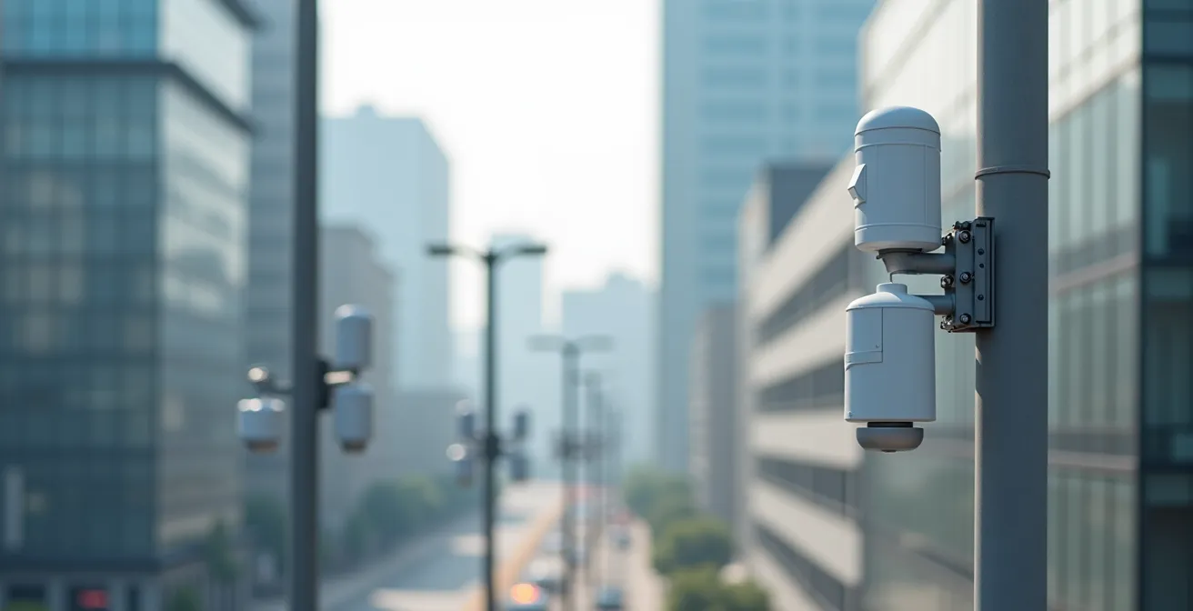
The true power of air quality monitoring now lies not in a few government stations, but in affordable, community-run IoT networks that deliver street-by-street data.
- Low-cost sensors, once dismissed as inaccurate, can now achieve near-reference-grade precision through advanced machine learning calibration.
- This hyperlocal data empowers citizens to understand personal exposure, advocate for policy changes like bike lanes, and build a more resilient, healthier urban environment.
Recommendation: Start by exploring local citizen science projects and leveraging personal monitoring apps to transform data into actionable health decisions.
The air we breathe in our cities is an invisible lottery. We know pollution is a problem, but traditional monitoring has always felt distant and abstract, relying on a handful of expensive, official stations that provide a single reading for an entire district. This city-wide average often masks the dangerous reality of pollution hotspots lurking on a specific street, near a busy intersection, or a construction site. We are told the air is ‘moderate’ while pedestrians on one block are inhaling levels of particulate matter far exceeding safety guidelines. Particulate matter, especially fine particles like PM2.5 (less than 2.5 micrometers in diameter), can penetrate deep into our lungs and bloodstream, causing significant health issues.
The conventional response has been to check these general reports and hope for the best. But what if the solution wasn’t just more of the same expensive technology, but a fundamental shift in who holds the data? The real revolution in fighting urban pollution is the democratization of environmental monitoring through the Internet of Things (IoT). It’s a move away from a top-down model towards a granular, citizen-powered network of low-cost sensors. This article explores how these networks are not just collecting data, but are creating actionable intelligence—empowering communities to identify risks, validate solutions, and demand change with evidence in hand. We will unpack how this technology works, prove its growing reliability, and show how it is being used to build healthier, more transparent cities from the ground up.
This guide will walk you through the key aspects of this technological and civic revolution. We will analyze the trustworthiness of modern low-cost sensors, explore how they uncover hidden pollution traps, and show how this data translates into automated health warnings and community-driven action.
Summary: Tracking Air Quality: How Citizen-Led IoT Networks Fight Pollution in Real-Time
- Low-Cost Sensors vs Reference Stations: Can You Trust the $50 Monitor?
- How to Identify “Street Canyons” Where Pollution Traps Pedestrians?
- When to Wear a Mask: Automating Health Warnings Based on PM2.5 Levels?
- The Traffic Link: Proving that New Bike Lanes Reduced Local Asthma Rates
- How to Organize a Community to Clean and Calibrate Public Sensors?
- Why Disruptive Tech Is Essential for Reducing Urban Carbon Footprints?
- How to Weatherproof IoT Sensors Against Extreme Urban Climates?
- Top-Down vs Bottom-Up: Which Smart City Model Do Citizens Actually Trust?
Low-Cost Sensors vs Reference Stations: Can You Trust the $50 Monitor?
The primary barrier to widespread adoption of citizen-led air quality monitoring has always been a single, legitimate question: are low-cost sensors accurate? For years, the data from affordable devices was considered too unreliable compared to the multi-thousand-dollar, government-operated reference stations. However, this perception is rapidly becoming outdated. The gap in accuracy is closing dramatically, not because the sensor hardware itself has become perfect, but because of the power of data science. Specifically, machine learning algorithms are revolutionizing sensor calibration.
By training models on data from both a low-cost sensor and a co-located reference station, it’s possible to create a correction algorithm that accounts for environmental variables and sensor drift. The results are transformative. For instance, recent research from Nature demonstrates that applying a Decision Tree calibration model can reduce the root mean square error of a low-cost sensor from a staggering 34.6 µg/m³ to just 0.731 µg/m³. This leap in precision brings affordable devices into the realm of scientifically valid tools, making them powerful instruments for hyperlocal monitoring. It’s no longer a question of whether you can trust a $50 monitor, but rather how well it has been calibrated.
This growing reliability is reflected in independent tests that compare the performance of commercially available monitors. These analyses help consumers and communities choose devices that offer the best balance of price and precision, further democratizing access to trustworthy environmental data. The table below highlights some top-performing models and their accuracy relative to reference standards.
| Monitor Model | Price Range | Accuracy (R²) | Key Features |
|---|---|---|---|
| PurpleAir PA-II | $150-250 | 95% | Weatherproof, real-time data |
| QP Pro/Lite | $100-200 | Lowest error rate ever tested | Government validated |
| Kaiterra Laser Egg | $199 | 70-85% | CO2 monitoring included |
| Aeroqual Series 500 | $1000+ | Under 70% | Multiple gas sensors |
How to Identify “Street Canyons” Where Pollution Traps Pedestrians?
City-wide air quality averages are misleading because pollution is not evenly distributed. One of the most significant examples of this hyperlocal variation is the “street canyon” effect. This phenomenon occurs in dense urban areas where tall buildings flank a street, creating a canyon-like structure. Vehicle emissions become trapped within this canyon, unable to disperse effectively into the atmosphere. As a result, pollutant concentrations at street level can be several times higher than the ambient air quality just a few stories up, or even on a more open, adjacent street.
Traditional monitoring stations, often placed on rooftops or in open parks, completely miss these dangerous hotspots. This is where a dense network of low-cost IoT sensors becomes indispensable. By deploying multiple sensors at different heights on building facades and along the length of a street, it’s possible to create a three-dimensional map of pollution. This granular data makes the invisible visible, revealing exactly where pedestrians, street-level vendors, and residents in lower-floor apartments are most exposed.

As the illustration demonstrates, a vertical array of sensors can precisely measure the pollution gradient, confirming that ground-level exposure is often the most severe. This hyperlocal data is not merely academic; it provides actionable intelligence for urban planners to redesign intersections for better airflow, for city governments to implement targeted traffic restrictions during high-pollution episodes, and for citizens to choose less-polluted routes for their daily commute or exercise. Identifying these street canyons is the first step toward mitigating their health impacts.
When to Wear a Mask: Automating Health Warnings Based on PM2.5 Levels?
Hyperlocal air quality data is most powerful when it translates into personal, timely health advice. Knowing that the PM2.5 level on your street is high is one thing; receiving an automated alert on your phone that says “High PM2.5 levels detected on your commute route – consider wearing a mask or taking an alternative path” is another. This is the promise of automated health warnings, a critical application of real-time IoT networks. Modern air quality apps are moving beyond simple data display to offer personalized and predictive features that empower individuals to proactively manage their exposure.
These applications can track real-time concentrations of six key pollutants, including PM2.5, PM10, ozone (O3), nitrogen dioxide (NO2), sulfur dioxide (SO2), and carbon monoxide (CO). Users can set up personalized alerts based on their specific health sensitivities, such as asthma, and receive notifications when pollutant levels breach their preset thresholds. For vulnerable populations, these automated recommendations—whether it’s to stay indoors, use an air purifier, or wear a high-filtration mask—can make a significant difference in preventing respiratory distress. The integration of pollen forecasts further enhances their utility for allergy sufferers.
Case Study: The Personal Exposure PM2.5 System (PEPS) in Beijing
To better understand individual exposure, researchers developed the PEPS, a wearable device for Beijing college students. This system monitored personal PM2.5 concentrations and uploaded the data in real-time, complete with localization. The project demonstrated how low-cost, automated data collection can generate massive datasets with minimal manpower, providing invaluable information for epidemiological studies on the direct health impacts of air pollution exposure. As the study highlights, such systems are crucial for understanding the real-world link between air quality and health outcomes in urban populations.
By connecting a network of stationary outdoor sensors with personal, wearable devices, it becomes possible to build a comprehensive picture of an individual’s total exposure throughout the day. This fusion of public and personal data is the future of environmental health management, transforming abstract numbers into concrete, life-saving actions.
The Traffic Link: Proving that New Bike Lanes Reduced Local Asthma Rates
One of the most compelling uses for a dense IoT sensor network is to provide objective, data-driven proof of the effectiveness of environmental policies. For decades, advocates for green infrastructure like protected bike lanes have argued that reducing traffic would improve air quality and public health. However, proving this causal link with hard numbers has been challenging with only a few official monitoring stations. A hyperlocal sensor network changes the game entirely, allowing for powerful “before and after” studies.
Imagine a city installs a new protected bike lane, removing a lane of car traffic. By deploying sensors along that corridor before construction begins and leaving them in place afterward, it’s possible to quantify the exact change in pollutant levels like NO2 and PM2.5. This data can then be correlated with public health statistics, such as emergency room visits for asthma in the immediate vicinity. This approach moves the conversation from “we think bike lanes help” to “we have data showing this bike lane reduced PM2.5 by 30% on this street, and local clinics reported a 15% drop in childhood asthma attacks.”

This evidence is crucial for justifying public investment in green transportation and overcoming political opposition. It provides a clear return on investment not just in environmental terms, but in public health outcomes and reduced healthcare costs. Furthermore, it reinforces the importance of tackling outdoor pollution sources, as their impact is not confined to the streets. The goal is to create a virtuous cycle: data proves the policy works, leading to more investment in similar policies, which further improves public health.
How to Organize a Community to Clean and Calibrate Public Sensors?
A citizen-powered IoT network is not a “set it and forget it” system. Sensors require regular maintenance—cleaning to remove dust and debris, and periodic recalibration to ensure data accuracy. The success of a bottom-up monitoring initiative depends heavily on sustained community engagement. So, how do you motivate a diverse group of volunteers to actively participate in the long-term upkeep of a public sensor network? The answer often lies in understanding human motivation and applying principles of gamification and community building.
Research into successful citizen science projects reveals a core set of motivational factors. A study on the SCORE project, which used a mobile app for flood monitoring, found that 93% of engagement could be attributed to ten key drivers. These include not only personal benefits and rewards but also social bonds, a sense of community, trust, and altruism. People are willing to contribute their time and effort when they feel part of a meaningful collective effort, trust the project’s goals, and see the direct impact of their work. Building a strong community of practice, where participants gain social status and pride through accurate monitoring, can be more powerful than monetary incentives alone.
Effectively engaging a community requires a thoughtful strategy that combines different incentive methods to appeal to various motivations. Creating a sense of shared purpose and making participation enjoyable and rewarding are key to the long-term sustainability of any citizen-led environmental project.
Action Plan: Designing a Community Sensor Maintenance Program
- Map Your Network: Identify and list all sensor locations and the specific maintenance tasks required for each (e.g., lens cleaning, power check, physical inspection).
- Create a Volunteer Toolkit: Assemble simple, clear instructions, a schedule for maintenance checks, and a list of necessary supplies (e.g., microfiber cloths, canned air).
- Build a Gamified System: Implement a points system in a companion app where volunteers earn badges for completing tasks, achieving high data quality, or training new members.
- Foster a Community Hub: Create an online forum or social media group where volunteers can share tips, post photos of their work, and see the collective impact of their efforts on a public data dashboard.
- Establish a Feedback Loop: Regularly share reports showing how the community’s well-maintained data has been used in local news, policy discussions, or scientific reports to reinforce a sense of purpose.
Why Disruptive Tech Is Essential for Reducing Urban Carbon Footprints?
While tracking pollutants like PM2.5 and NO2 has immediate public health benefits, the same IoT infrastructure is a cornerstone for a much larger battle: reducing a city’s overall carbon footprint. The granular, real-time data generated by these networks provides the “ground truth” needed to design, implement, and validate large-scale sustainability initiatives. This bottom-up, data-driven approach is a disruptive force, challenging traditional, slow-moving methods of urban planning and environmental management.
For example, by understanding traffic flow and associated emissions on a hyperlocal level, cities can implement dynamic congestion pricing, optimize traffic light timing to reduce idling, and design more efficient public transport routes. The same sensor networks can be integrated with building management systems to automate energy consumption based on real-time occupancy and outdoor environmental conditions. The key is moving from static models to a dynamic, responsive urban ecosystem.
Furthermore, this technology fosters a culture of sustainability awareness. As demonstrated by the Green Awareness in Action (GAIA) research project, implementing IoT-based monitoring in European schools and using gamification and educational activities significantly increased awareness and promoted energy-efficient behavior among students. When people can see the direct, real-time consequences of their actions—whether it’s choosing to bike instead of drive or reducing electricity usage during peak hours—they become active participants in the city’s climate goals. This disruptive technology doesn’t just measure the problem; it engages the entire community in being part of the solution.
How to Weatherproof IoT Sensors Against Extreme Urban Climates?
Deploying a sensor network across a city means exposing sensitive electronics to the full force of the urban climate: blistering summer heat, freezing winter temperatures, torrential rain, and high humidity. These environmental factors don’t just pose a physical threat to the hardware; they can significantly compromise the quality of the data. For an IoT air quality network to be trustworthy, it must be both physically robust and algorithmically intelligent enough to compensate for weather-induced inaccuracies.
Temperature and humidity are notorious for affecting the performance of electrochemical sensors. For example, recent calibration studies confirm that ozone (O3) sensors show a mean average error of 14 μg/m³ when calibrated with a single feature, but that error drops to just 6 μg/m³ when temperature, humidity, and cross-sensitivity to other gases like NO2 are included in the calibration model. This demonstrates that robust data quality isn’t just about the sensor itself, but about the intelligence of the calibration algorithm and its ability to correct for environmental interference in real-time.
On the physical side, weatherproofing involves designing durable, sealed enclosures (often rated to IP67 or higher) that protect the internal components from moisture and dust. Material selection is also key to prevent degradation from UV radiation and extreme temperatures. Real-world, long-term deployments, like the year-long Envirowatch E-MOTE project in Sheffield, United Kingdom, are crucial for testing and proving the resilience of these systems. Despite weather challenges, the network successfully captured clear temporal pollution cycles, proving that with proper engineering and smart calibration, low-cost sensors can provide reliable data year-round, forming the resilient backbone of a modern smart city.
Key Takeaways
- The future of air quality monitoring is hyperlocal and citizen-powered, moving beyond inaccurate city-wide averages.
- Advanced machine learning has made low-cost sensors reliable enough for scientific and civic use, closing the gap with expensive reference stations.
- Community engagement through gamification and shared purpose is essential for the long-term maintenance and success of a distributed sensor network.
Top-Down vs Bottom-Up: Which Smart City Model Do Citizens Actually Trust?
The conversation around “smart cities” has often been dominated by a top-down vision: a municipality or large corporation implements a vast, centralized technology infrastructure to manage urban services more efficiently. While efficient, this model can feel opaque and alienating to residents, who may view it as a form of surveillance rather than a community benefit. The rise of citizen-led IoT networks for air quality represents a powerful alternative: a bottom-up smart city model built on principles of transparency, participation, and trust.
In this model, citizens are not just end-users of a service; they are active co-creators of the city’s data infrastructure. They own the sensors, participate in their maintenance, and have open access to the data they generate. This fosters a level of trust and ownership that top-down systems struggle to achieve. When data about a local pollution problem comes from a sensor maintained by a neighbor, it carries a different weight and credibility than a report from a distant government agency. This approach transforms residents from passive subjects into “citizens as sensors,” creating a digital agora for civic participation.
CS [Citizen Science] apps raise awareness of environmental problems by engaging citizens in observing and documenting issues using gamification techniques. The platform format enables geoparticipation similar to real participation in decision-making, contributing to a digital agora based on ‘citizens as sensors’ and ‘no one left behind’ principles.
– Olszewski and Wendland, Humanities and Social Sciences Communications
Ultimately, the most successful and resilient smart city initiatives will likely be hybrids, combining the scale and resources of top-down systems with the trust, granularity, and engagement of bottom-up, community-led projects. By empowering citizens with reliable, understandable, and actionable data about their own environment, we build not just a smarter city, but a more engaged, equitable, and democratic one.
To put these principles into practice, the next logical step is to engage with local citizen science initiatives or use a personal air quality monitor to begin tracking your own environment.